|
| *****SWAAG_ID***** | 600 |
| Date Entered | 01/09/2012 |
| Updated on | 01/09/2012 |
| Recorded by | Tim Laurie |
| Category | Settlement |
| Record Type | Archaeology |
| SWAAG Site | Grinton Pastures |
| Site Access | Public Footpath |
| Record Date | 01/01/2005 |
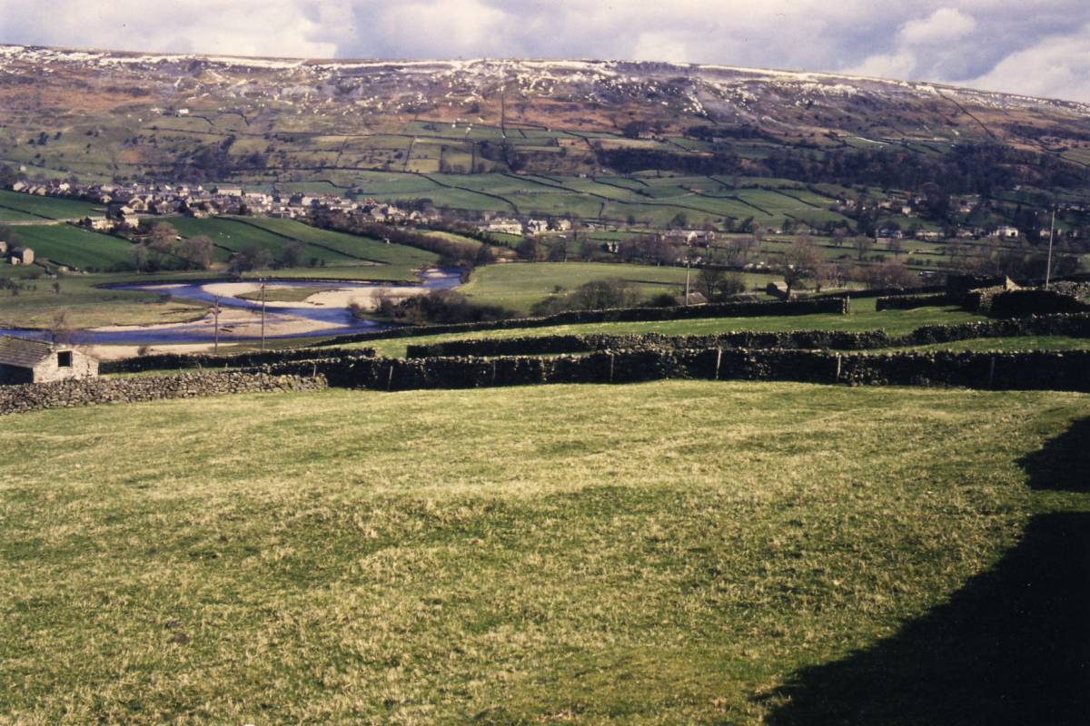
| Location | Grinton Pastures east of Plaintree Farm |
| Civil Parish | Grinton |
| Brit. National Grid | SE 030 983 |
| Altitude | 250m |
| Geology | Glacial drift over Middle Limestone |
| Record Name | The Grinton Pastures. Multi period settlement east of Plaintree Farm |
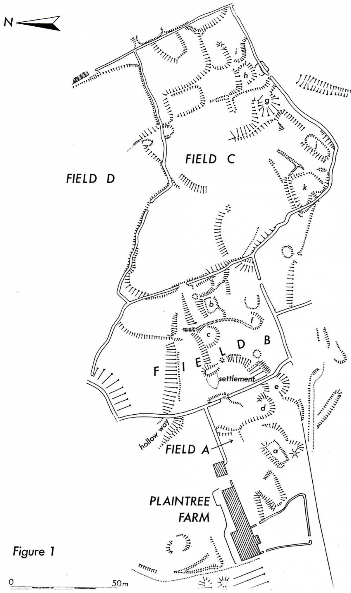
| Record Description | See Swaledale Ancient land Boundaries Project Survey Plan attached. Complex settlement on the same contour as the medieval settlement of Hercay comprising many small paddock like enclosures with associated rectilinear and curvilinear house platforms denoting settlement occupation across many centuries, from the period of Roman occupation to the medieval period. |
| Dimensions | 250m in length from west to east *100m deep from south to north, see plan. |
| Additional Notes | See Fleming, A.1998 Fig.9.6 and text for further description of this complex settlement. |
| Image 1 ID | 3278 Click image to enlarge |
| Image 1 Description | Plaintree Farm Settlements. SWALB Survey. |  |
| Image 2 ID | 3279 Click image to enlarge |
| Image 2 Description | Plaintree Farm Settlements. Detail of part of the settlement in permanent pasture east of Plaintree Farm. |  |